- Why Mining Matters
- Jobs
- Safety
-
Environment & Operations
- FAQ
- Links
-
Fun Stuff


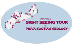


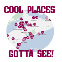


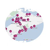
44 GEOLOGICALLY SIGNIFICANT SITES IN NOVA SCOTIA
The Government of Nova Scotia created the following list of 44 geologically-significant regions throughout Nova Scotia. Below are descriptions of the sites, organized by tourist region.
Evangeline Trail
The Evangeline Trail, found along Nova Scotia’s Fundy shore between Yarmouth and Windsor, is named after Longfellow’s poem Evangeline: A Tale of Acadie which was inspired by the Acadian heritage found in this section of Nova Scotia.
1. Cape Forchu – Cape Forchu, located near Yarmouth and popular among tourists for its apple core shaped lighthouse, shows evidence of Nova Scotia’s once active volcanoes. Cape Forchu is comprised of Silurian volcanic rocks.
2. Cape St. Mary – The cliffs at Cape St. Mary, part of Nova Scotia’s French Acadian shoreline, are comprised of metamorphosed sedimentary rocks from the Cambrian-Ordovician age. Similar rocks can also be found along sections of the Lighthouse Route (the Blue Rocks) and the Marine Drive (Taylor Head).
3. Digby – A fold in Cambrian-Ordovician rocks can be seen on the eastbound offramp of Highway 101 at Exit 24.
4. Digby Neck and the Islands – Both Brier and Long Island are made up of Jurassic basalt lava. As the lava cooled, it sometimes formed vertical polygonal columns such as Balancing Rock in Tiverton.
5. North Mountain Shore – Dramatic cliffs and headlands, formed by Jurassic basalt lava flows, mark this area of Nova Scotia. The vesicular tops of these flows created the ideal setting for the formation of the mineral crystals such as zeolites, amethyst and agates. Communities popular for their mineral crystals include Harbourville, Halls Harbour and Scots Bay.
6. Blomidon – Over 200 million years ago, when Nova Scotia was in the subtropics, red Triassic sedimentary rocks formed in lakes and rivers in what is now the Province’s Annapolis Valley. These rocks form the cliffs found in this region, including those in Blomidon.
7. Blue Beach – Sandstones and mudstones deposited along the shores of Carboniferous period lakes created Nova Scotia’s Blue Beach. Geological sights at Blue Beach include 350 million year old ripple marks, raindrop prints, fossil plants, fish scales and amphibian footprints.
8. St. Croix – Those traveling along Highway 101 from Halifax are able to view the white gypsum cliffs at St. Croix. Similar to the salt mined at Pugwash and the limestones along the banks of the Kennetcook River, St. Croix gypsum is a sedimentary deposit of the tropical “Windsor Sea” that covered this region during the Carboniferous period. Marine life, such as horn corals found in limestone, thrived in this “sea”.
Glooscap Trail
The Glooscap Trail, named after the native god who is said to have created Fundy’s great tides, runs along the Fundy shoreline between the provincial border at Amherst and Windsor.
9. Milford – Low oval to dome-shaped hills, known as Drumlins, are made up of sediment leveled and shaped by glaciers throughout the last 100,000 years in Nova Scotia. Drumlins make excellent farmlands. In addition to the Milford and Shubenacadie regions of Nova Scotia, Halifax’s Citadel Hill and the islands in Mahone Bay are examples of drumlins.
10. Noel Shore – Tightly folded Carboniferous sandstones and mudstones overlain by slightly tilted red Triassic sandstones and conglomerates are found along the Noel Shore. The boundary between these two types of rocks, known as an unconformity, can be seen at Rainy Cove, near Pembroke. This unconformity signifies a gap of over 100 million years that is missing from these rocks.
11. Burntcoat Head – Located along the southern shore of the Minas Basin, Burntcoat Head is officially home to the highest tides ever recorded. On October 5, 1869 the difference between low and high tide measured 54ft or 16.5m at Burntcoat Head.
Burntcoat Head is also a great location to view red Triassic sandstones and conglomerates, some of which display unique cross bedding created by currents of the rivers that once flowed through this area.
12. Truro-Victoria Park – Victoria Park’s Lepper River cuts through Carboniferous sandstones built up in ancient rivers.
13. Five Islands – Mi’kmaw legend says that the native god Glooscap created these five islands – Moose, Diamond, Long, Egg and Pinnacle – when he threw chunks of sod at Beaver. Signs throughout the park provide visitors with information about the region’s geology and it is easy to spend the hours of low tide beachcombing. Sea dramatic cliffs with Jurassic lava flows covering primarily red Triassic sedimentary rocks, Jurassic sandstones and mudstones and a white layer that shows the boundary between the Triassic and Jurassic eras – marking one of Earth’s great extinction events.
14. Parrsboro – The largest community along the north shore of the Minas Basin, Parrsboro is an excellent place to witness the incredible power of the Fundy tides. These tides, the highest in the world, sculpt the coastline daily uncovering fossils, zeolites and semi-precious stones.
Canada’s oldest dinosaur skeletons have been discovered in Jurassic sedimentary rocks near Parrsboro at Wasson Bluff. Rocks in this area are mostly comprised of complexly faulted and tilted Jurassic sediments and volcanics, making it difficult for the average beachcomber to see the fossils here.
Minerals such as green celadonite, stilbite and chabazite can also be found throughout this region. In addition, breathtaking views can be enjoyed from the impressive basalt cliffs at Cape d’Or, near Advocate Harbour.
15. Port Greville – Two small continental fragments collided and slid against one another approximately 390 million years ago to create what is now the Province of Nova Scotia. The boundary, known as the Cobequid-Chedabucto Fault System, similar to California’s San Andreas Fault, is an important feature of geological and topographical maps of Nova Scotia. Where the Fundy lowlands meet the Cobequid Highlands, just north of Parrsboro at Crossroads, is a good place to view the scarp of the Cobequid Fault.
16. Cape Chignecto – Comprised of 600-foot towering cliffs, 18 kilometres of pristine coastline, steep ravines and old-growth forests, Cape Chignecto Provincial Park is found on the Western tip of the Avalon Eco-Zone along the Bay of Fundy. Not only is the park a great place to observe the tides, as they continuously lap at the base of the cliffs, Cape Chignecto is home to some of the province’s most significant geological deep valleys.
As Fundy’s powerful tides beat against and erode the Devonian-Carboniferous rocks at Cape Chignecto, a trio of sea stacks, known as the Three Sisters, were created and stand watchfully over the Chignecto Bay.
17. Joggins – Located at the head of the Bay of Fundy, the 75-foot high cliffs at Joggins are exposed to constant tidal action and as Fundy’s 50-foot tides erode the cliffs, new fossils are revealed including a rich variety of flora, diverse amphibian fauna, important trackways and some of the world’s first reptiles. The Joggins Fossil Cliffs became famous in 1851 with the discovery of fossilized tree trunks found in their original positions. When these trunks were closer examined, tiny bones were noticed which turned out to be one of the most important fossil discoveries in Nova Scotia. These remains were from one of the world’s first reptiles and evidence that land animals had lived during the “Coal Age”. Today the Joggins Fossil Cliffs are recognized in a world-class palaeontological site.
Sunrise Trail
Nova Scotia’s Sunrise Trail commences at the provincial border, near Amherst, and follows the coastline along the Northumberland Strait to Aulds Cove, just before the causeway to Cape Breton.
18. Malagash – Although they may appear as if they were created just days ago, the ripple marks found at Treen Bluff near Malagash were formed by rivers that flowed across the sandy flood plains during the Carboniferous era. Throughout the years, these sediments have turned into rock and tilted almost vertically.
19. Cape John – The coastal lowlands found along Nova Scotia’s North Shore showcase underlying, easily eroded Carboniferous-Permian sedimentary rocks. Other such rocks can also be found across Northumberland Strait, creating Prince Edward Island’s famous red cliffs.
20. Arisaig – Formed mainly of Silurain sedimentary rock, the cliffs at Arisaig contain a variety of fossils including crinoid, brachiopods, nautilods, trilobites and graptolites.
21. Antigonish – Monk’s Head – A mix of limestone, gypsum and siltstones, of the Carboniferous Windsor Group, make up the cliffs at Monk’s Head. Gypsum can also be found on the other side of Antigonish in the Crystal Cliffs.
Cape Breton Island
Cape Breton Island is best known for its celebration of the Scottie Culture and the picturesque Cabot Trail that runs through the Highlands.
22. Port Hood – Port Hood is home to one of the most beautiful beaches in Nova Scotia and during the Carboniferous era a forest existed here that contained club moss trees that may have been up to 50 meters high.
23. Mabou Mines Harbour – Cliffs overlooking Mabou Mines Harbour expose Carboniferous sedimentary rocks that are cut by faults recognizable by observing where the sedimentary layers end. White rocks, or Windsor gypsum, can also be seen in the cliffs to the right of the fault. In addition to the fault and the gypsum, an unconformity exists in the low cliffs behind the small beach to the southeast of the wharf.
24. Inverness – Pieces of coal, leftover from Carboniferous era sedimentary rocks and the area’s long history of coal mining, are scattered over Inverness Beach. Unusually petrified tree trunks can also be found in the Inverness region.
25. Baddeck – In areas underlain with gypsum rocks from the Carboniferous Windsor Group, such as limestone, potash and rock salt, depressions and caves, like the sinkhole found just north of the Trans-Canada highway in Baddeck, are common finds as the gypsum is easily dissolved by groundwater.
26. Cheticamp – The landscape seen from the MacKenzie Mountain look-off was formed by ancient gneiss and granite. Over the years, erosion has reworked this location into a tableland with V-shaped valleys created by fast-flowing streams.
27. Aspy – West of the North Aspy River, a dramatic change in slope marks the line of the Aspy Fault. The highlands in this region are comprised of ancient metamorphic rocks, while the lowlands are formed of softer Carboniferous sandstones and mudstones.
28. Ingonish – Neils Harbour – The movement of glaciers throughout the last Ice Age combined with constant erosion have worn down the headlands, comprised of Devonian granite, at Neils Harbour.
29. Sydney – Glace Bay – The low cliffs at Victoria Beach are made up from alternating Carboniferous sediments of sandstones, mudstones, coal and limestone. Also in this region, Sydney Mines, Glace Bay and Point Aconi showcase extraordinary examples of fossil tree trunks and other plant remains.
30. Louisbourg – The lighthouse in Louisbourg is situated on Precambrian igneous rocks created from ash that was spewed into the atmosphere while the volcanoes were active. Igneous dykes can also be viewed from at Kennington Cove.
Marine Drive
Nova Scotia’s Marine Drive, as known as the Eastern Shore, runs along the Atlantic Ocean between Cape Breton and Halifax and is often remembered for its pristine beaches, tranquil coves and lively salt marshes as well as its numerous parks, historic sites and fishing villages.
31. Canso Causeway – Constructed of precambrian granite quarried in the 1950’s from Cape Porcupine, the Canso Causeway connects Cape Breton to mainland Nova Scotia. The low-lying Cape Breton side of the causeway is underlain with Carboniferous rocks.
32. Canso – The coastline surrounding Canso, as well as Durell Island, are comprised of Cambrian-Ordovician metamorphosed sedimentary rocks. Today, in some places, the sedimentary beds are nearly vertical.
33. Eastern Shore – Once valleys, severely concave inlets along Nova Scotia’s Eastern Shore have engulfed by the sea throughout the last few thousand years. Most of the small islands along this shore are drumlins. Cliffs at such places as Wine Harbour and Lawrencetown are cut into the drumlins.
34. Taylor Head – Glaciers formed the majority of Nova Scotia’s landscape during the last ice age, ending just 12,000 years ago. One of the features left behind by glacier erosion is a roche moutonnée (sheep rock), like the one in Taylor Head Provincial Park and those in the Peggy’s Cove area. A roche moutonnée has one gentle smooth slope and one steeper, more ragged slope.
The bedrock at Taylor Head is Cambrian metamorphosed sandstone.
35. Clam Harbour – The expansive beaches, for which the Eastern Shore is known, are formed of sand derived from the erosion of older rocks by rivers, glaciers and the Atlantic Ocean.
Halifax Metro
While the Halifax Regional Municipality is best known for its impressive mixture of culture and heritage, there are some interesting geological sites in this region as well.
36. Eastern Passage – Striations were created from ice-borne debris at the base of a glacier during the glaciation, between 25,000 and 12,000 years ago. In addition to being found in Eastern Passage, these striations can also be seen at Black Rock Beach and Point Pleasant Park’s Martello Tower.
37. Halifax – Many of the offices and warehouses that were constructed during the 19th century in downtown Halifax were built from locally derived rocks. Ironstone, a Cambrian-Ordovician fine-grained metamorphosed sedimentary rock, along with granite and sandstone trim, was a popular choice in building what is now referred to as the Historic Properties.
Citadel Hill, site of the Halifax Citadel National Historic Site, is an example of a drumlin.
38. Lower Sackville - Mount Uniacke – On a roadcut on Highway 101, between Lower Sackville and Mount Uniacke, are vertically tilted, Cambrian metasedimentary rocks. The tilting took place nearly 390 million years ago when two small plates of continental crust merged with each other along the Codequid-Chebucto Fault System.
39. Chebucto Head – Much of the southern interior of Nova Scotia is underlain with Devonian granite including the impressive cliffs and rocks at Chebucto Head.
Lighthouse Route
The Lighthouse Route, which runs between Yarmouth and Halifax, is home to such picturesque communities such as Peggy’s Cove, Mahone Bay and Lunenburg.
40. Peggys Cove – The large Devonian granite rocks on which the famous Peggy’s Cove Lighthouse sits were smoothed by glaciers that withdrew approximately 12000 years ago. This granite was formed around the time of the earliest amphibians, which was about 160 million years before the appearance of the first dinosaurs.
41. Tancook – Although many of the islands found in Mahone Bay are drumlins, the two Tancook Islands – Big Tancook and Little Tancook – are comprised of Cambrian-Ordovician metamorphosed sedimentary rocks. While metamorphism usually destroys fossils, fossil burrows can be found here.
42. Blue Rocks – At Blue Rocks, the Cambrian-Ordonvician rocks – that were once sedimentary – have been compressed into metamorphic rocks. The original beds, the light and dark bands, were distorted when rock were buried and crushed by the movement of tectonic plates. Rocks similar to these can be found in Eastern Passage and Halifax’s Point Pleasant Park.
43. Kejimkujik National Park – In Kejimkujik National Park there is a granite boulder, sometimes referred to as a glacial erractic, that was smoothed and transported to the park by glacial action during the last ice age. Today the boulder supports the roots of a large, stately tree.
44. Kejimkujik Seaside Adjunct – White beaches and low granite headlands make up Kejimkujik National Park’s seaside adjunct. Devonian granite began as molten magma. As the magma slowly cooled several kilometers beneath the surface, large crystals of glassy quartz, dark mica and pink, white or buff feldspar were created. Uplift, weathering and erosion throughout the last 380 million years have removed the overlying rock.
Explore 8 famous Nova Scotian geological sites in more detail:
Peggy's Cove | Halifax Harbour | Citadel Hill | Cape Breton Highlands | Sable Island | Bay-of-Fundy | Cobequid-Chedabucto Fault System | Kejimkujik National Park | Nova Scotia Geology